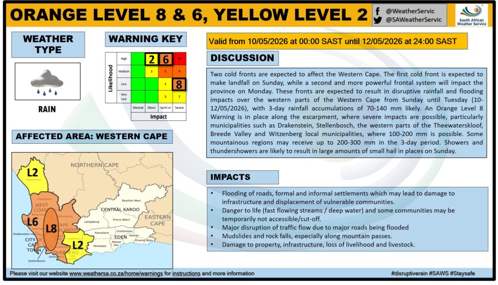
The South African Weather Service has issued another level 8 severe storm warning, alerting the country to a significant cold front that is about to hit the Western Cape.
According to the SAWS, the level 8 warning is in effect from Sunday, 10 May, to Tuesday, 12 May, flagging disruptive rainfall, strong winds and damaging waves.
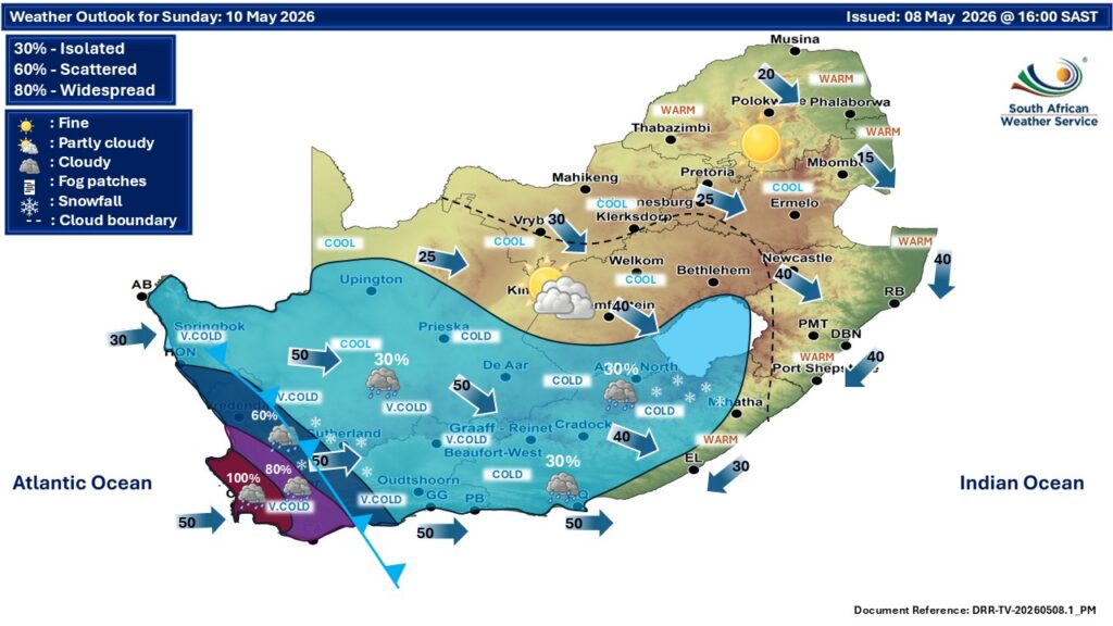
While the Western Cape is expected to suffer the brunt of the storms, inclement weather is anticipated in the southern parts of the Northern Cape as well.
The weather service warned that the impact of the cold front is likely to result in the flooding of roads and settlements, formal and informal.
This will likely lead to major disruptions on major roads, as well as difficult and dangerous driving conditions.
It also flagged very cold, wet and windy conditions impacting livestock and agricultural production, and dangerous seas.
“This weather system is expected to result in widespread disruptive rainfall, strong to gale-force winds, very rough seas, and significantly colder temperatures over the western interior and coastal regions,” it said.
The areas that should be on high alert are the City of Cape Town, the Cape Winelands and Overberg, it said.
It issued the following warnings for 10 – 12 May 2026.
Orange level 8 warning
- Areas: The mountainous regions of the Drakenstein, Stellenbosch, the western parts of the Theewaterskloof, Breede Valley and Witzenberg local municipalities of the Western Cape.
- Conditions: Disruptive rainfall leading to flooding of roads, bridges and formal and informal settlements, mudslides and danger to life due to fast-flowing rivers.
Orange level 6 warning
- Areas: West Coast, Cape Winelands, City of Cape Town, and the western parts of the Overberg District of the Western Cape
- Conditions: Disruptive rainfall leading to flooding of roads, low-lying bridges, and formal as well as informal settlements
Orange level 6 warning
- Areas: Along the coast between Lambert’s Bay and Plettenberg Bay (Western Cape)
- Conditions: Damaging winds and waves leading to danger to navigation at sea and damage to coastal infrastructure.
Orange level 5 warning
- Areas: Parts of the Cape Winelands and the western parts of the Central Karoo Districts of the Western Cape.
- Conditions: Damaging interior winds leading to damage to formal and informal settlements, power interruptions, and the closure of some routes due to falling trees.
Yellow level 4 warning
- Areas: Between Alexander Bay and Lambert’s Bay (Western Cape)
- Conditions: Damaging winds and waves leading to danger to navigation at sea is expected along the coast.
Yellow level 2 warning
- Areas: Parts of the West Coast, City of Cape Town, Overberg and Central Karoo Districts, as well as the Kannaland Municipality of the Western Cape, including the southern Namakwa District of the Northern Cape.
- Conditions: Damaging winds leading to localised damage of informal settlements, falling trees and localised problems for high-sided vehicles on prone routes.
Yellow level 2 warning
- Areas: Karoo Hoogland municipality of the Northern Cape, and in places over the Cape Winelands District of the Western Cape
- Conditions: Disruptive snowfall leading to loss of vulnerable livestock, disruption of traffic due to icy roads and possible closure of mountain passes.
The public is strongly advised to:
- Monitor official weather updates and warnings issued by the South African Weather Service.
- Avoid unnecessary travel during periods of heavy rain and flooding.
- Never attempt to cross flooded roads, bridges, or swollen rivers.
- Secure loose outdoor objects that may be displaced by strong winds.
- Exercise extreme caution along coastal areas and avoid fishing or recreational activities at sea during the warning period.
- Provide adequate shelter, warmth, and protection for livestock and pets.
- Prepare emergency kits, including flashlights, batteries, warm clothing, blankets, and essential supplies.
- Community leaders and disaster management authorities are encouraged to remain on high alert and activate contingency plans where necessary.
“Members of the public and stakeholders are strongly urged to continuously monitor official SAWS forecasts and warnings, as warnings will be updated as the likelihood and severity of impacts become
clearer,” it said.